
Making models better
We continuously try to improve dBSea, and many of our ideas come from user giving us valuable feedback relating to their uses and needs.
As part of dBSea 2.0 (available January 31, 2017) we will include wider import and export opportunities to make workflow simpler and better. In this post I'll briefly describe one of these improvements, namely the handling of shapefiles.
For the uninitiated, shapefiles are vector files used to describe points, lines or areas along with their attributes for use in Geographical Information System (GIS). It is common to get shapefiles that are geotagged and designate a particular area of interest, such as a construction site or natural reserve.
I recently posted a video on the subject, so if you're more into listening than reading, have a look below.
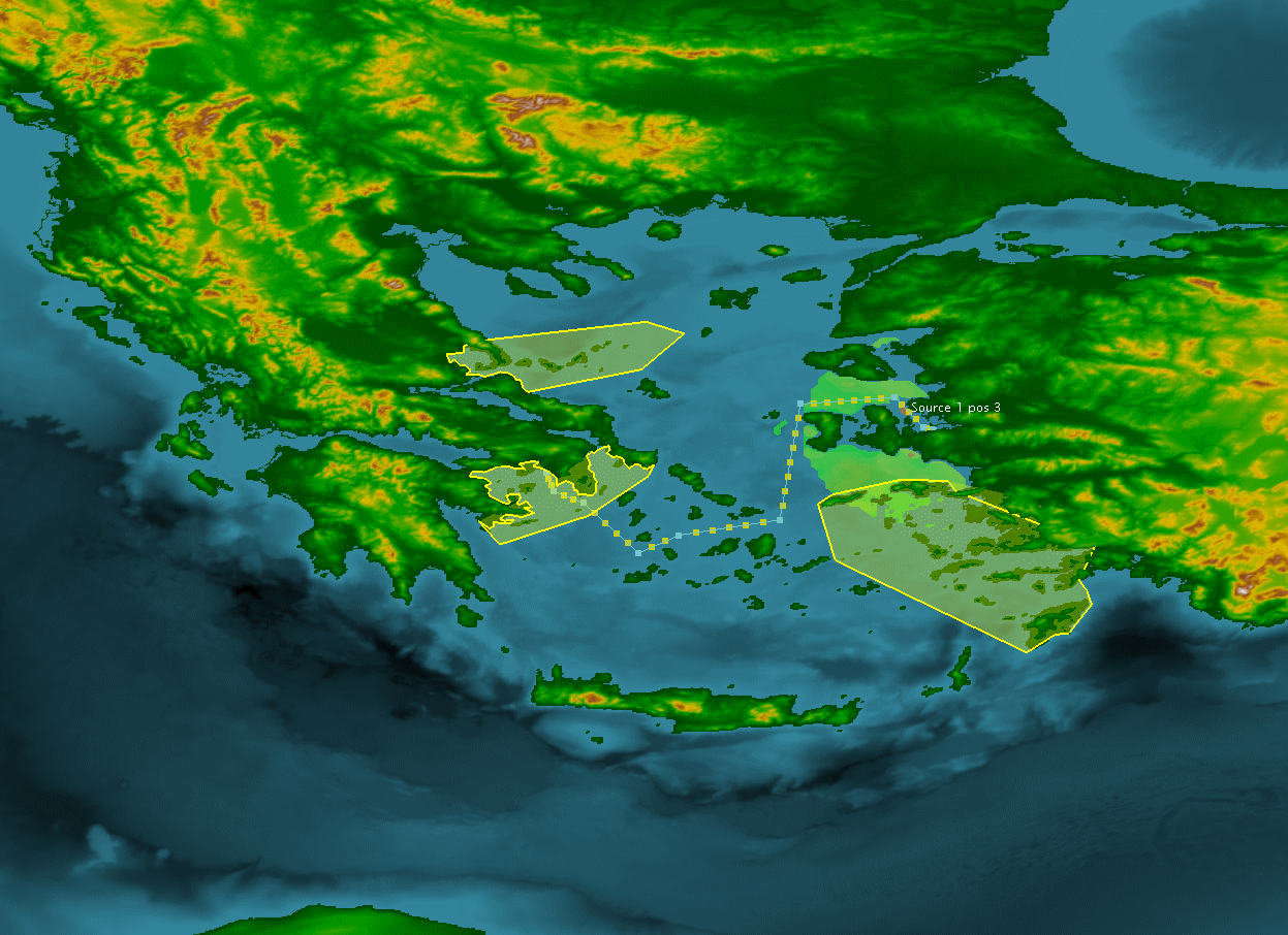
As it's wintertime here, and rather cold, I opted for the Aegean Sea between Greece and Turkey, as a setting for this example. The ACCOBAMS project has proposed several Marine Protected Areas (MPA's) in the Aegean Sea, I have plotted three of them in the picture below (Figure 1).
 |
| Figure 1. The Aegean Sea. Green dotted line is ferry from Izmir in Turkey to Athens in Greece, red area is exclusion zone from dBSea and yellow areas are proposed Marine Protected Areas. |
Areas like these MPA's are often given as areas bounded by a set of coordinates in a .shp, or shapefile format. These shapefiles can now be imported into dBSea and the effects of source level, species weightings and mitigation can be seen directly in relation to zones of interest.
 |
| Figure 2. The same scene as in figure 1, but in dBSeas' renderer. |
With the option of also exporting shapefiles directly from dBSea, exclusion zones, like the red area/line in the above figures, can be easily integrated into any other map, for later presentation or editing. This new functionality makes GIS integrations like what I did in an earlier post ("There's a real world out there") much easier - especially if GIS work is not your speciality, and you'd just like to get on with it!
And for the ending - I must admit I like the animation tool more than I should.
 |
| Figure 3. Animation of the ferry from Izmir to Athens. We have tried to give you more tools to present your work, both directly from dBSea and in conjunction with other software. |
Thanks for reading - please feel free to comment and/or ask questions!
Comments
Post a Comment